Mapping Platform for NEMT & Paratransit Software

Routes are always up-to-date and accurate

3D city map illustration with streets, rivers, parks, and buildings

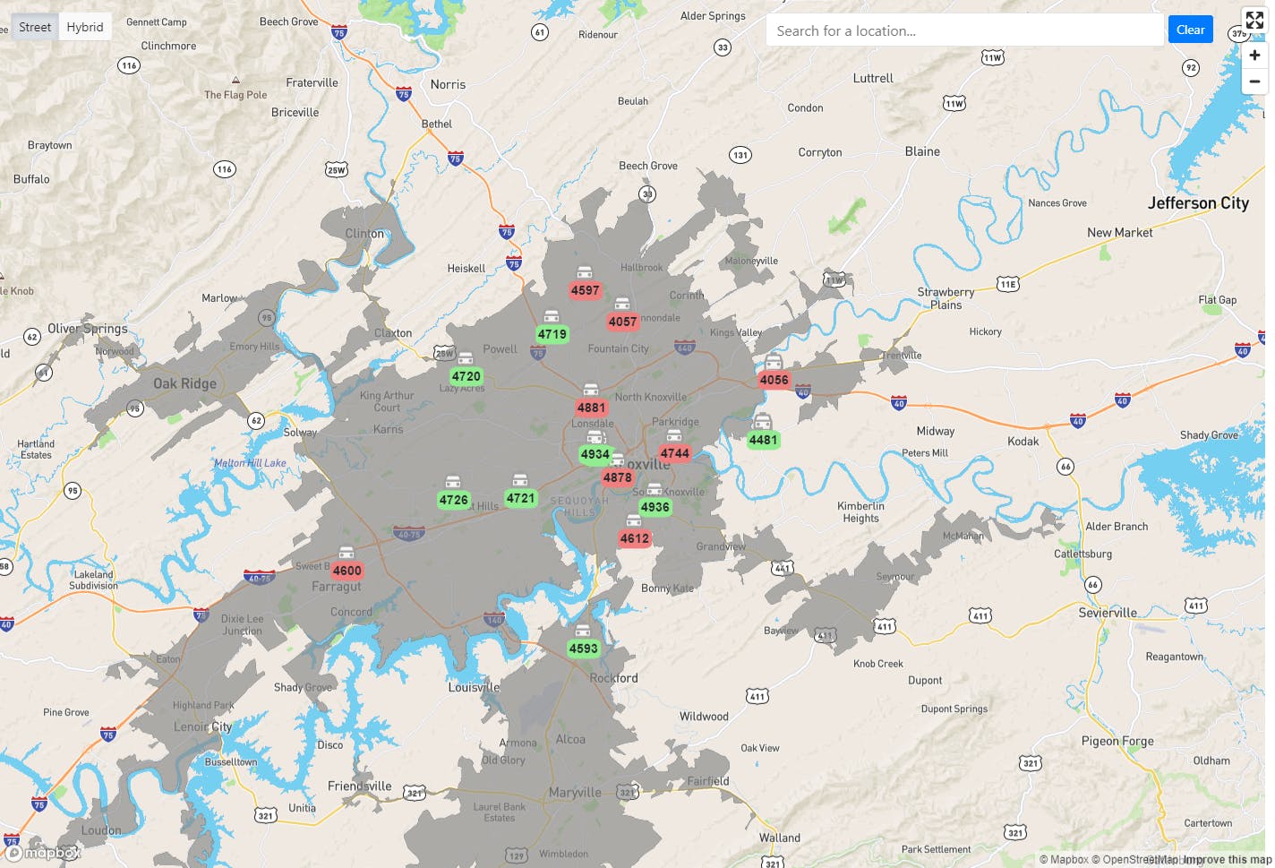
Automated Vehicle Location

TripMaster’s detailed mapping engine is updated quarterly to reflect new or closed roads, speed limit adjustments, and other critical information.

Comprehensive solutions include:

  • Visual displays of rides and routes
  • Turn-by-turn directions
  • Drive time and mileage calculations
  • Quarterly map updates
  • Satellite view of locations while scheduling rides
Request a Demo

With the drivers using tablets, they have become more efficient with their schedules and have the ability to do more trips in a day. Our drivers range from ages 25-85, and each one has expressed great satisfaction with ParaScope.”

Gateway ServicesPrinceton, IL

Stay on track & on time

With accurate real-time data, drivers have access to the most accurate listed and turn-by-turn directions possible. Accurate mapping allows you to create precise custom reports for drive time and mileage.

Request a Demo
TripMaster mapping interface showing a regional map with vehicle locations marked in green and red.

Some of our Featured Clients

Metro Transit Logo
Garrett County Community Action Logo
Rutherford County Transit Logo
Wave Transit Logo
OUTS logo
Metro Transit Logo
Garrett County Community Action Logo
Rutherford County Transit Logo
Wave Transit Logo
OUTS logo
TripMaster by Transit Technologies 

Logo

Support

  • (800) 555-3546

  • techsupport@cts-software.com

Sales

  • (800) 704-0064

  • sales@cts-software.com

Footer badge
Footer badge
Google Business Reviews 5 Stars
Capterra Review Badge
© 2025 CTS Software. Copyright 2025. All rights reserved.